![]()
![]() BACK
BACK
![]()
![]() INDIETRO
INDIETRO
AFRICA
clicca sull'immagine per vederla ingrandita, con descrizione - click on the image preview to enlarge and to see the description
![]()
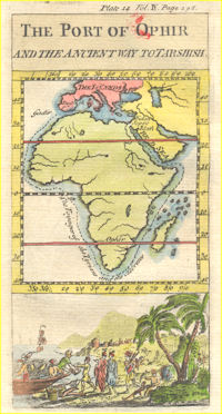
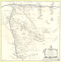
| Africa | THE PORT OF OPHIR and the Ancient Way Totarshish, 1740 €. 50,00 |
|
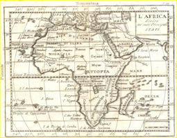
| Africa | L'AFRICA Divisa ne' suoi Princiali Stati, 17..? €. 50,00 |
|
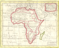
| Africa | L'AFRIQUE Suivant les dernieres Observations de l'Acad.Royale des Sciences, 1744 €. 60,00 |
|
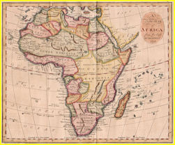
| Africa | A New Map of AFRICA from the best Authorities, 1797 €. 80,00 |
|
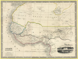
| Africa | AFRIQUE OCCIDENTALE, 18? €. 40,00 |
|
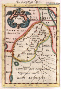
| Africa | NUBIE, 1684 €. 40,00 |
|
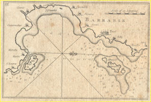
| Africa | BARBARIE , 18..? €. 40,00 |
|
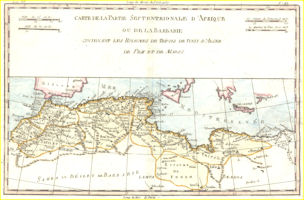
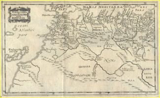
| Africa | CARTE DE LA PARTIE SEPTENTRIONAL D'AFRIQUE OU DE LA BARBARIE CONTENANT LES ROYAUMES DE TRIPOLI DE TUNIS D'ALGER DE FEZZ ET DE MAROC, 1780 €. 100,00 |
|
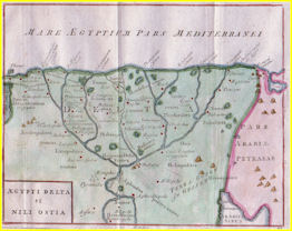
| Africa Egitto | ÆGYPTI DELTA et NILI OSTIA Cellarius 1798 €. 80,00 |
|
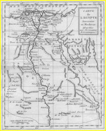
| Africa Egitto | CARTE DE L'EGYPTE Laporte 1786 €. 60,00 |
|
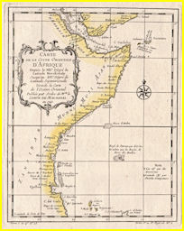
| Africa Orientale/ East Africa | CARTE DE LA COSTE ORIENTALE D'AFRIQUE ..., Bellin 1740 €.100,00 |
|
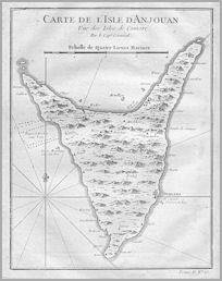
| Africa Orientale/ East Africa /Anjouan/ Union of Comoros | CARTE DE L'ISLE D'ANJOUAN,Bellin 1740 €.60,00 |
|
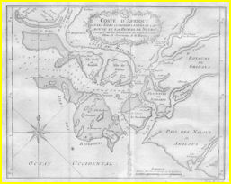
| Africa Occidentale/ West Africa /Guinea | COSTE D'AFRIQUE et les Isles comprises entre le Cap ROUGE et la Riviere deNunho,Bellin 1747 €.60,00 |
|
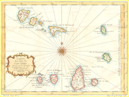
| Capo Verde | CARTE DES ISLES DU CAP VERD , 1746 €. 120,00 |
|
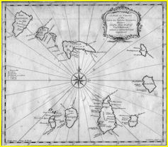
| Capo Verde | A Map or Chart of the CAPE DE VERDE ISLANDS , 1750 €. 90,00 |
|
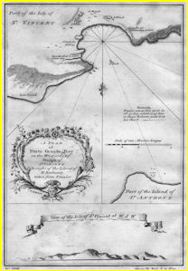
| Capo Verde | A Plan of PORTO GRANDE BAY , 1750 €. 80,00 |
|
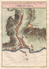
| Capo Verde | PLAN DE LA VILLE ET DES FORTS DE St. JAGO, 1750 €.36,00 |
|
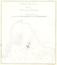
| Capo Verde | PORT PRAYA DANS L'ISLE DE St. JAGO, 17..? €.36,00 |
|
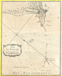
| Egitto / Egypt | RADE DU BEQUIER, 1764, €.60,00 |
|
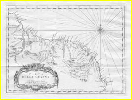
| Guyana | CARTA DELLA GUYANA,1780 €. 80,00 |
|
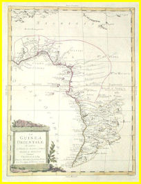
| Guinea | LA GUINEA ORIENTALE che contiene li Regioni di LOANGO, CONGO, ANGOLA e BENGUELA, Zatta, 1784 €. 170,00 |
|
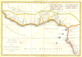
| Guinea | Royaumes, Etats et pays de la HAUTE GUINEE par M. Bonne, Ingen. Hydrographe de la Marine, 1778 €. 130,00 |
|
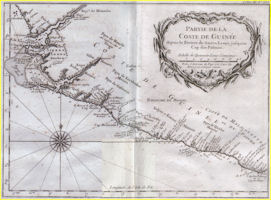
| Guinea | PARTIE DE LA COSTE DE GUINÉE depuis la Riviere deSierra Leona jusq'au Cap das Palmas, Bellin 1747 €. 120,00 |
|
| Mauritania | MAURITANIA et AFRICA PRPRIA nunc BARBARIA, Cluverius, 1694 €. 60,00 VENDUTA |
|
|
Senegal-Mali / eastern Sengal & western Mali |
A Map of Part of the Rivers FALEME & SANAGA with the Countries of BAMBUK & TAMBA AWRA, Kitchin, 1744, €.100,00 |
|
![]()
![]()
![]() BACK
BACK
![]()
![]() INDIETRO
INDIETRO